UX5 Aerial Imaging Rover
Inventory Classification
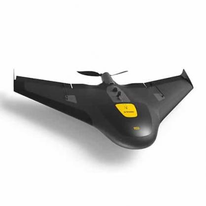
The Trimble UX5 Aerial Imaging Solution is setting the standard for fast and safe aerial data collection by offering a complete system with powerful technologies such as reversed thrust & automatic fail-safe procedures, a robust design and radically simplified workflow.
•Ensures optimal image quality along with maximum photogrammetric accuracy.
•Combines impact resistant foam structure and internal and external composite elements for extreme durability and strength.
•Design ensures employability nearly everywhere and in practically all weather conditions.
University Tag Number:
191577
Availability:
Contact Custodian for availability
Location
Ag & Biosystems Engr
Room Number:
121
Acquisition Date:
June 30, 2014